The Hurricane Hunters
By venturing directly into the eyes of hurricanes, dare-devil meteorologists have made tracking and forecasting nature’s deadliest storms much easier.
Editor's Note: Eric Jay Dolin is a writer with degrees in environmental science and environmental policy from Brown, Yale, and MIT. His most recent book is A Furious Sky: The Five-Hundred-Year History of America's Hurricanes (Liveright), from which this essay was adapted.
It had been exceptionally rainy during the summer of 1938 in the Northeast, but Wednesday, September 21, was shaping up to be a nice reprieve, starting out warm and mostly sunny, promising to be a beautiful day. Despite the pleasing weather, however, the news was full of storm clouds on the horizon.
After wading through twenty-six pages of international and domestic news in the September 21 issue of the New York Times, readers in New York and New England would have seen, nearly hidden in the bottom left-hand corner of page 27, a short article on an approaching hurricane, which had been born a few weeks earlier in Africa. The paper reported that the storm would weaken as it sailed off into the North Atlantic. It might cause gale-force winds and high surf later in the afternoon or evening along portions of the coast, but those effects were not of great concern.
The Great Hurricane of 1938 moved so fast that journalists dubbed it “The Long Island Express.”
Readers of the Times article were certainly not surprised by the forecasted trajectory. It was conventional wisdom among northeasterners that hurricanes menaced the southeastern and Gulf coasts of the country, not their part of the world. While hurricanes had, of course, struck Long Island and New England before, the last one that had even come close had been thirty-five years earlier, in 1903, and that storm had been relatively minor. Before that, one had to go back to the mid-nineteenth century before finding a major hurricane that had hit so far north.
Plus, the New York Times report was based on another authority: the U.S. Weather Bureau, which had tracked the storm as it moved up the coast. Looking at the sparse data, chief forecaster Charles Mitchell concluded that the storm would do what Cape Verdean hurricanes almost always did—namely, continue curving around the high-pressure dome in the North Atlantic called the Bermuda High, which tends to steer hurricanes north, parallel to the coast, and then away from the mainland into the open ocean. Mitchell also assumed that as the hurricane traveled farther north, it would rapidly weaken over the colder ocean waters, transitioning from a hurricane to a gale before dying out in the frigid North Atlantic.
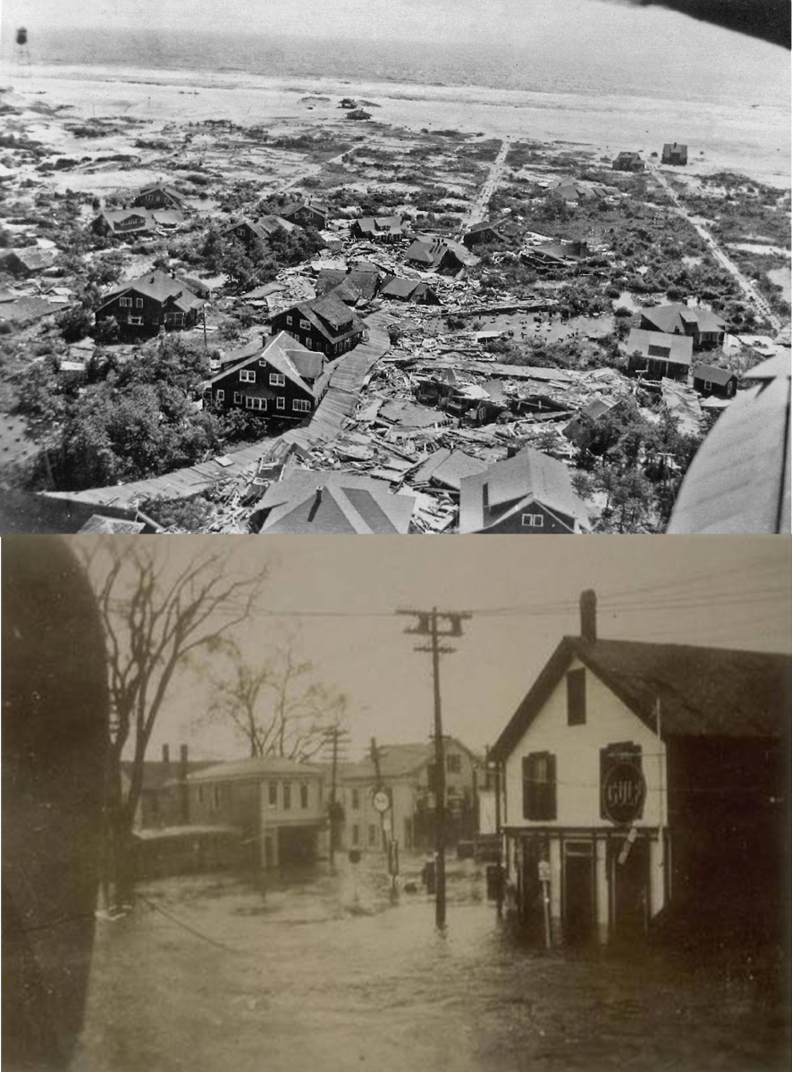
The forecast, unfortunately, was terribly wrong. Mitchell and others watched as the still powerful hurricane zoomed north, making a beeline for the coast. It came ashore in Suffolk County, Long Island, and then blasted into southern New England as a Category 3 hurricane, packing sustained winds of up to 120 mph. It raced over the open ocean at the blistering speed of 50–60 mph, rather than the 20–30 mph that is more typical of Cape Verdean hurricanes in the North Atlantic. The Great Hurricane of 1938 moved so fast that journalists dubbed it “The Long Island Express.”
Once the skies cleared and the nation had some space for reflection, the failure to forecast the hurricane brought an avalanche of criticism down on the Weather Bureau. But the agency could not be blamed too harshly. Ever since the Weather Bureau had begun forecasting hurricanes, its efforts had been severely hampered by the paucity of real-time data about what was happening over the ocean. Sure, there were times when ships not already scattered because of earlier warnings provided valuable information. And if the hurricane passed near or over an island that had a weather station, another data point was generated.
But what the bureau desperately needed to avoid forecasting debacles like the calamity of the Great Hurricane of 1938—not to mention hurricanes before and after it—was more data about hurricanes at sea. If only there were a way to get closer to hurricanes to obtain data as they traveled over the ocean, far from land; then, meteorologists mused, tracking and forecasting them would be much easier.
If only there were a way to get closer to hurricanes to obtain data as they traveled over the ocean, far from land; then, meteorologists mused, tracking and forecasting them would be much easier.
Behemoths of The Sky
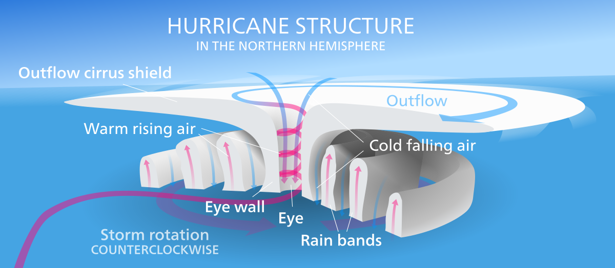
Hurricanes are violent, swirling storms with sustained winds of at least 74 mph. They generally form where the ocean’s upper layer—down to about 150 feet—reaches the trigger temperature of at least 80 degrees Fahrenheit, thereby providing the massive amounts of heat energy needed to fuel them. Two other conditions necessary for a hurricane to thrive are low vertical wind shear, which keeps the hurricane from being ripped apart, and an abundance of warm, moist air that evaporates from the ocean surface. When that moist air rises, it cools and condenses, forming clouds and releasing the heat that powers the storm.
Hurricanes can be anywhere from tens of miles in diameter to more than a thousand, and over 50,000 feet high, reaching from the ocean’s surface all the way up to the top of the troposphere. These behemoths rotate in a counterclockwise direction in the Northern Hemisphere and clockwise in the Southern. But wherever and however they spin, hurricanes are characterized by extremely low pressure and a relatively calm center called the eye, with the most ferocious winds occurring in the eyewall and decreasing in intensity as one travels outward from the core. Hurricanes whip up the seas, generate gargantuan waves and mammoth storm surges, and pour down such diluvial quantities of water that they seem to presage the end of time.
Hurricanes also discharge vast quantities of energy. Considering only the wind, an average hurricane produces the equivalent of half of the world’s electrical generating capacity. But hurricanes produce even more energy when water vapor condenses to form clouds—a type of energy known as the latent heat of condensation. By this measure, an average hurricane produces the equivalent of two hundred times the world’s generating capacity. To put it another way, an ordinary hurricane releases the same amount of energy as 10,000 nuclear bombs. For a major hurricane the number is higher still.
To put it another way, an ordinary hurricane releases the same amount of energy as 10,000 nuclear bombs.
Since the late 1800s, meteorologists involved with tracking and forecasting hurricanes have looked to the sky for answers. Their ability to get them, however, was severely limited because information came mainly from observations on the ground or from a small number of ships that just happened to be unlucky enough to be in the storm’s path. By the 1930s, weather balloons carrying instruments aloft were increasingly employed by the Weather Bureau, but they were no match for a hurricane’s vicious winds, which often destroyed the balloons and the instruments before valuable data could be gathered.
The First Hurricane Hunter
World War II made a different kind of monitoring possible. Since time immemorial, wars have spurred innovation and ingenuity while also sowing death and destruction. Nothing focuses the mind like a threat to one’s existence, and World War II certainly had that impact on America, where the imperative to win fueled advances in numerous fields. Meteorology, and hurricane science in particular, became one of the beneficiaries.
Weather doesn’t comply with the needs of war; therefore, US military commanders knew that pilots had to be capable of flying in good conditions and bad if they were to take full advantage of every strategic and tactical opportunity. That meant the pilots had to rely on their instruments, and not just visible landmarks, to guide their way (flying by visible landmarks is called contact flying). To teach its pilots how to master instrument flight—the art and science of being able to fly even when weather conditions hide the ground and the horizon as a reference—the air force asked pilot Joseph B. Duckworth to lead the way.
Born in Savannah, Georgia, in 1902, Duckworth earned his air force wings in 1927 and went into the private sector, ultimately becoming a pilot for Eastern Airlines in 1930. As a commercial pilot intent on keeping to a schedule and flying in all types of weather, he taught himself the art of instrument flying, which had only been developed in 1929. When he returned to active duty in 1940, Duckworth began training air force pilots to gain the same proficiency.
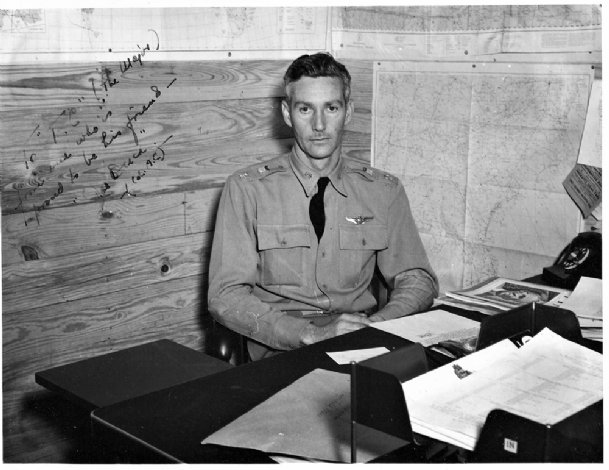
By 1943, Duckworth, now a lieutenant colonel, was the commanding officer of the air force flying school in Bryan, Texas. He taught his students instrument flying on the AT-6 “Texan” trainer, a single-engine, two-seater workhorse that was nearly 30 feet long, with a 42-foot wingspan. On July 27, the Weather Bureau alerted the military that a hurricane in the Gulf of Mexico would soon be coming ashore in Galveston. This warning prompted the air force to consider flying the AT-6’s to another base farther inland to protect them from harm. That’s when the ribbing started.
Among Duckworth’s students were a bunch of grizzled British flying aces who had earned their stripes battling the German Luftwaffe over the skies of Europe. They had no experience with hurricanes, however, and viewed them as nothing more than bad thunderstorms. When such storms threatened in Britain, planes remained on the tarmac. So, when the Brits heard over breakfast on the twenty-seventh that the military brass were thinking of sending the planes inland in advance of the hurricane, they started making fun of the supposed fragility of the AT-6.
The lanky Georgian sat up straight in his chair, cast his British trainees a wry smile, and offered them a wager. After disabusing them of the idea that hurricanes were merely bad thunderstorms, Duckworth bet them that he could fly an AT-6 into the hurricane and then return to the base. Such a flight would vindicate the strength of the plane, as well as the reliability of instrument flying. The loser, Duckworth said, would buy the winner a drink of his choice.
Duckworth needed a navigator, so he asked the only one at the base that day, Ralph O’Hair, to join him. O’Hair was hesitant. His main concern was what would happen if the heavy rain within the hurricane flooded the plane’s single engine and it stopped working. The most likely answer— that they would crash and die—was hardly reassuring. The thought of ejecting from the crippled plane and parachuting to safety didn’t seem like a practical or safe alternative either. Nevertheless, O’Hair agreed to go along, as he later recalled, because of “the respect he had for Duckworth’s skill as a pilot.”
Though Duckworth and O’Hair were outwardly cool, their pulses certainly quickened as they approached the unknown.
Since this “experimental instrument flight” into a hurricane’s path would be a first and was potentially very risky, Duckworth didn’t think he could get clearance from his superiors at headquarters. So he didn’t ask. Early that afternoon, the two men flew in the direction of the Category 1 hurricane as it swept in over the coast. On the way, they radioed Houston’s air traffic control tower. When they informed the startled operator that they were heading to Galveston, he thought he must have heard wrong, and he asked them whether they knew there was a hurricane at Galveston. “Yes, we do,” O’Hair responded. “We intend to fly into the thing.” Since the operator couldn’t stop them, he asked that they report in every now and then to keep him updated. “Evidently,” according to historian Ivan Ray Tannehill, “he wanted to be able to say what became of the plane if they went down in the storm.”
Though Duckworth and O’Hair were outwardly cool, their pulses certainly quickened as they approached the unknown. When they entered the hurricane at an altitude of between 4,000 and 9,000 feet, a gray darkness descended, torrents of rain poured down, and visibility went to near zero as the plane was buffeted by violent updrafts and downdrafts. O’Hair said it felt like they were “being tossed about like a stick in a dog’s mouth.”
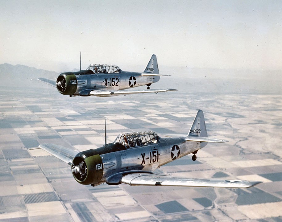
Originally, the plan was to fly into the outer edge of the hurricane and then come back. But before Duckworth could execute a turn, the plane broke through the eyewall. While circling inside, surrounded by what O’Hair called “a shower curtain of darker clouds,” the men could see the Texas countryside below. Duckworth exited the eye and returned to the airfield about two hours after their trip began.
Word of their unauthorized flight had filtered through the ranks, and when they landed, the base’s weather officer, Lieutenant William Jones-Burdick, was there to greet them. Disappointed that he had not been asked to go on the first excursion, but still eager to take advantage of so momentous of an opportunity, he convinced Duckworth to make a second flight so that he, too, could see the hurricane up close. Jones-Burdick took O’Hair’s place, and off they went. Unlike the first flight, during which neither men took notes, this time both Duckworth and Burdick-Jones recorded as much data as they could, including descriptions of the hurricane’s structure and temperature variations.
That evening there was a joyous celebration at the officers’ club, where all of Duckworth’s students, most especially the British, toasted their fearless teacher. Although he had broken the rules by taking off that day without permission and venturing into the hurricane, Duckworth was later awarded the Air Medal for his singular act of meritorious achievement.
Hurricane Hunting Takes Flight
News of the historic flights excited Francis W. Reichelderfer, who had become chief of the Weather Bureau a few months after the Great Hurricane of 1938. Ever since the Great Labor Day Hurricane of 1935, the strongest landfalling hurricane by maximum sustained winds ever recorded, the bureau had wanted to explore the possibility of flying near hurricanes to gather information. Despite lobbying for such flights, the bureau had failed to gain any traction for its bold idea. Duckworth’s success, however, changed the calculus by proving that planes could fly not only in the vicinity of hurricanes but also directly into them.
The flight also attracted the military’s attention. Despite being only a Category 1 storm, the July 1943 hurricane caused considerable damage to Texas’s oil industry and temporarily shut down the refinery that provided most of the nation’s aviation fuel. This painful disruption jolted the Joint Chiefs of Staff into action. Now that Duckworth had proved that airplanes could monitor a hurricane’s progress, the Joint Chiefs authorized additional flights in the hope that they would provide earlier warnings of a hurricane’s approach. That way the military could better prepare, should a hurricane threaten a base or suppliers of critical war matériel.
Now that Duckworth had proved that airplanes could monitor a hurricane’s progress, the Joint Chiefs authorized additional flights in the hope that they would provide earlier warnings of a hurricane’s approach.
Reichelderfer was overjoyed by this turn of events because the military was not going it alone. While the air force and the army would be flying the planes, the flights would be supervised jointly by the military and the Weather Bureau out of the latter’s facility in Miami, which replaced Jacksonville in 1943 as the nation’s primary hurricane forecasting office. Bureau meteorologists would be on the planes to gather valuable data. The man who would decide when those flights would launch and where they would go was Grady Norton, the bureau’s chief hurricane forecaster.
The value of so-called Hurricane Hunter flights became apparent the following year. Responding to news of a strong tropical disturbance in the Atlantic about 250 miles north of Puerto Rico, Norton dispatched a navy plane to investigate on September 10, 1944. It found a fully developed hurricane with tremendous winds roughly estimated to be 140 mph. At several points during that flight, the pilot feared that the plane might burst apart or crash into the ocean, and when it returned to base, an inspection showed that 150 rivets had been sheared off one of its wings. So powerful was this storm that the bureau dubbed it the Great Atlantic Hurricane of 1944.
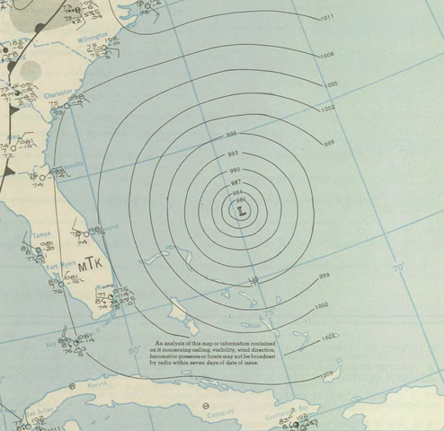
Over the next four days, as the hurricane continued north, paralleling the coast, Norton sent out six more reconnaissance flights. When the hurricane finally made landfall, plowing into eastern Long Island and southern New England on September 14, it had winds in excess of 100 mph, with gusts much higher. It then tracked over Rhode Island and Massachusetts before heading into Massachusetts Bay and the broader Atlantic.
While this hurricane bore some similarity to the Great Hurricane of 1938 in terms of trajectory and landfall, it was far less damaging to people and property. Of the 390 deaths, only 46 occurred on land. The rest came from the sinking of ships at sea, most notably the USS Warrington, which lost 247 men when it capsized about 450 miles east of Vero Beach, Florida; 68 crewmen survived and, after forty hours in the water, were saved by other ships. The cost of the hurricane was $100 million. Although the bulk of that damage occurred after landfall, there was considerable destruction from the mid-Atlantic north, as the massive hurricane side-swiped the coast.
The Great Hurricane of 1944 was much less damaging than the one in 1938 in part because it was weaker on landfall, it hit at low tide and at an oblique angle to the coast, and, since so many buildings had been destroyed six years earlier, there were fewer left to damage. But the reconnaissance flights deserve much credit as well. The information they provided helped the bureau issue timely hurricane advisories. As Time magazine reported a few weeks later, “Hour after hour, radio stations from Delaware to Maine cried the alarm, like pygmies running ahead of a mad elephant. The people listened to the loudspeakers. Families were evacuated from coastal areas where people had been trapped in 1938.” The officers on the Warrington, too, had received multiple weather advisories telling them that a hurricane was headed toward them, but for reasons that are not entirely clear, they ignored the warnings. The result of their refusal was a death toll higher than it might otherwise have been.
Hurricane Hunting Today
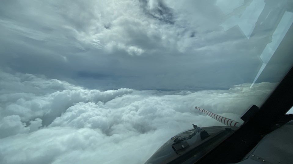
From these humble beginnings grew today’s impressive fleet of hurricane hunting planes, which are now operated by the Air Force Reserve Command’s 53rd Weather Reconnaissance Squadron and the National Oceanic and Atmospheric Administration (NOAA). These planes get their marching orders from the National Hurricane Center in Miami, Florida, which is part of NOAA’s National Weather Service (the Weather Bureau was absorbed into NOAA in 1970, and renamed the National Weather Service).
These planes are flying data-collecting marvels full of high-tech instruments and trained meteorologists, not to mention first-rate pilots and navigators.
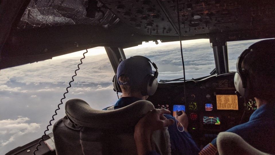
When the National Hurricane Center identifies a tropical disturbance of note that is close enough to land to be reached by a round trip on a single tank of fuel, it sends Hurricane Hunter planes to investigate. These planes, which include Lockheed WC-130J’s and WP-3D Orions, are flying data-collecting marvels full of high-tech instruments and trained meteorologists, not to mention first-rate pilots and navigators, whose job is to gather information that is used by the National Hurricane Center to assess the disturbance and, if need be, issue tropical storm or hurricane watches or warnings.
One of the key instruments on board is radar (which stands for “radio detection and ranging”), a technology developed during World War II. Originally intended to detect enemy aircraft, radar was also found to have meteorological applications. More specifically, it uses the scattering and reflection of microwaves to identify, visualize, and analyze all sorts of weather phenomena, including hurricanes. Among the many things that radar can do is locate and display the outlines of the hurricane, such as the eye and eyewall, as well as measure rainfall intensity. Radar is deployed not only on Hurricane Hunters but also on land, where it provides the same services to meteorologists tracking tropical storms and hurricanes as they come closer to the coast and travel inland.
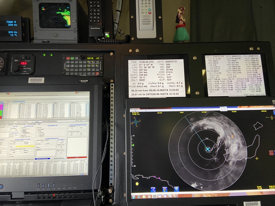
Another critical instrument is the dropsonde (or dropwindsonde), a cylindrical and expendable weather device packed with sensors that measure temperature, humidity, and pressure. It also contains a global positioning system antenna and receiver that make possible the tracking of wind speed and direction. As the name implies, the dropsonde is dropped from a Hurricane Hunter through a launch chute that extends through the plane’s fuselage. Deploying a mini parachute, the dropsonde floats down through the hurricane while its radio transmits all the measurements back to the plane every 0.5 second. One other key piece of equipment is the Stepped-Frequency Microwave Radiometer (SFMR), which can measure wind speed just above the ocean’s surface, as well as precipitation rates, in real time.
There have been thousands of Hurricane Hunter flights over the years. Despite the violence of hurricanes, such flights are relatively safe. One Hurricane Hunter pilot said that “the most dangerous part of his day is not flying through the eye of a hurricane, it’s driving to the runway and climbing a steep ladder to get on board the plane.”
The main danger during a Hurricane Hunter flight is not the straight-line winds—after all, commercial jets often fly in the jet stream with or against winds of 150 mph or more—but rather sudden updrafts or down-drafts. Under the best of circumstances these can make for a very bumpy flight, and in the worst cases they can rip the plane apart. While most hurricane hunting flights are relatively routine, if not quite grueling, more than a few have been downright scary. Early Hurricane Hunter crews called such flights “hairy hops.”
During one hairy hop in 1945, the navigator provided a colorful description of his experience flying through a hurricane with wind speeds of 125 mph. “One minute this plane, seemingly under control, would suddenly wrench itself free, throw itself into a vertical bank and head straight for the steaming white sea below. An instant later it was on the other wing, this time climbing . . . at an ungodly speed. To ditch would be disastrous. I stood on my hands as much as I did on my feet.” A short while later, this man, who had more than 1,500 hours of flight time and had never once been airsick, lost his “cookies.”
The Muppets
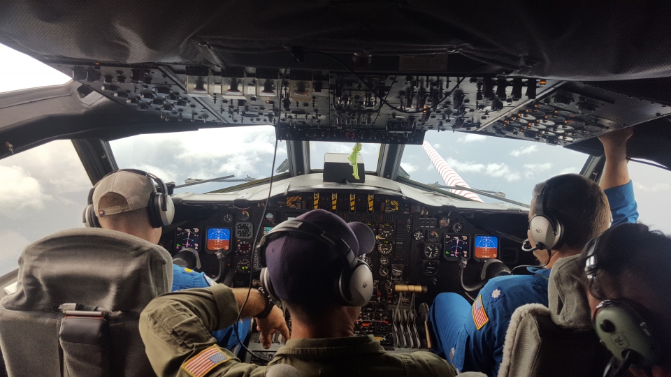
A September 1989 flight into Hurricane Hugo, a Category 5 that was approaching the Lesser Antilles and would later make landfall in South Carolina as a Category 4, was one of the worst. As the NOAA plane Kermit, named after the beloved Muppets character, flew through the eyewall at a very low altitude of 1,500 feet, Dr. Jeff Masters, the flight director, recounted the terror.
"Darkness falls. Powerful gusts of winds tear at the aircraft, slamming us from side to side. Torrential rains hammer the airplane. . . . A fierce updraft wrenches the airplane, slams us into our seats with twice the force of gravity. Seconds later, we dangle weightless as a stomach-wrenching downdraft slams us downward. Thick dark clouds suddenly envelop the aircraft. A titanic fist of wind, three times the force of gravity, smashes us. I am thrown into the computer console, bounce off, and for one terrifying instant find myself looking DOWN at a precipitous angle. A second massive jolt rocks the aircraft. Gear loosened by the previous turbulence flies about the inside [of] the aircraft, bouncing off walls, ceil- ing, and crewmembers A third terrific blow, almost six times the force of gravity staggers the airplane Terrible thundering crashing sounds boom through the cabin; I hear crewmembers crying out. . . . We are going down. . . . The aircraft lurches out of control into a hard right bank. We plunge towards the ocean, our number three engine in flames. Debris hangs from the number four engine. The turbulence suddenly stops. The clouds part. The darkness lifts. We fall into the eye of Hurricane Hugo."
Gravely injured but still flying, Kermit circled within the eye. To lighten the load so that the plane could ascend to a safer altitude before attempting to exit the hurricane, the pilot dumped 15,000 of the 50,000 pounds of fuel. The meteorologists continued to collect what weather information they could, and to help get rid of additional weight they deployed all twenty-two of the expendable bathythermographs on board, which radio back measurements of water temperature and ocean current speed and weigh about 30 pounds each. The main goal at this point shifted from data gathering to sheer survival, and on that score Kermit received a huge assist from two other Hurricane Hunters that had been sent out with Kermit to explore Hugo—NOAA’s Miss Piggy and the air force’s Teal 57.
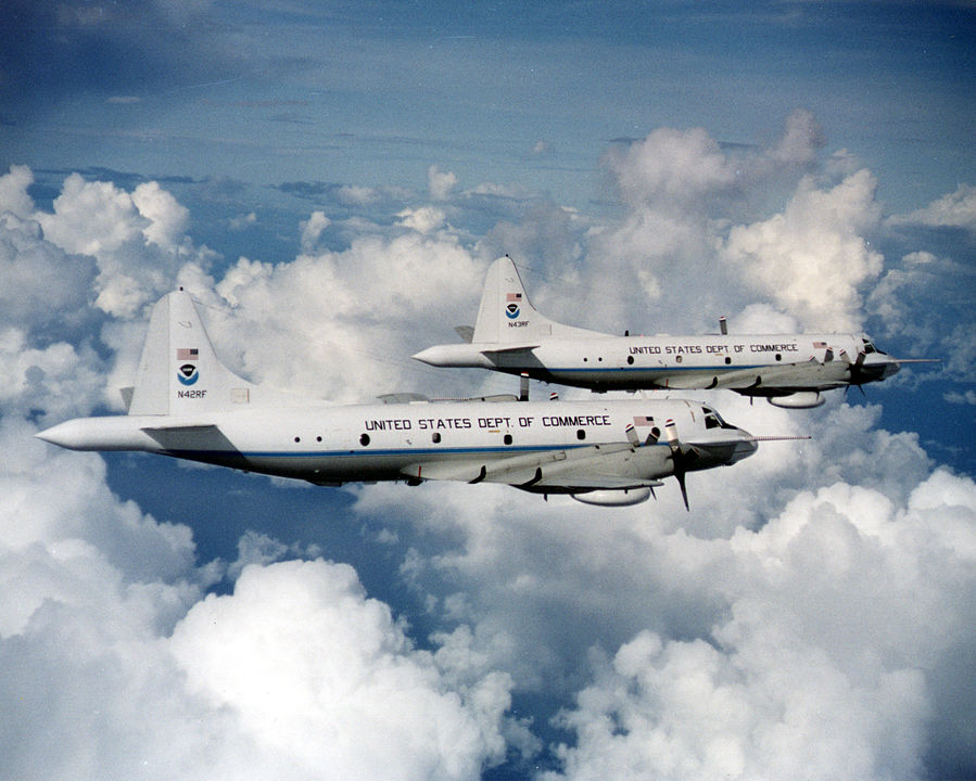
Upon learning of Kermit’s dire situation, Miss Piggy and Teal 57 entered the eye. They circled and penetrated the eyewall at various locations, searching for a “soft spot” where the turbulence was less. Finally, Teal 57 found it at about 7,000 feet, and Kermit followed the air force plane out of the hurricane. The exit was another wild ride, with winds of 170 mph, gusts up to 190 mph, and a few terrific updrafts, but it was not as bad as the entry, and within a couple of minutes it was all over. “Praise God!” yelled the exuberant Masters. “The sun never looked so good. We are alive!”
Kermit returned to the airfield on Barbados. It sat out the rest of the 1989 hurricane season but, after repairs, was back in action the next year. As terrifying as Kermit’s flight was, there are a few that were far worse.
Six Hurricane Hunter planes have crashed, killing all on board. Of those, five were doing reconnaissance on typhoons in the Pacific. The only Hurricane Hunter lost in the Atlantic was in 1955, when a crew of eleven, including two reporters, flying out of Guantánamo Bay, went down over the Caribbean Sea while investigating a Category 4 hurricane named Janet. The last clear radio transmission, which came in at 8:30 a.m. on September 26, ended with “beginning penetration.” Almost two hours later, another message arrived, but it was garbled. Despite a massive search operation, not a single piece of debris was ever found.
The data gathered by Hurricane Hunters, as well as through additional means, such as satellites and weather balloons, helped meteorologists make great strides in understanding hurricane dynamics.
The data gathered by Hurricane Hunters, as well as through additional means, such as satellites and weather balloons, helped meteorologists make great strides in understanding hurricane dynamics. Key discoveries since the 1940s include identifying the role of African easterly waves in the genesis of hurricanes and highlighting essential factors in hurricane development, among them water temperatures of at least 80 degrees Fahrenheit to a depth of about 150 feet, and low vertical wind shear. Other breakthroughs include a better understanding of the influence of upper-atmosphere steering currents in determining a hurricane’s path, and a much richer and fuller picture of the anatomy of hurricanes from top to bottom.


