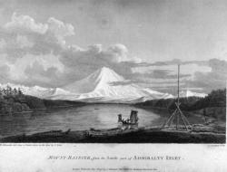
The voyage of Captain George Vancouver, 1791 -1795, was commissioned by the British Admiralty to map in detail the west coast of North America from Mexico to Alaska and to meet with Spanish authorities on the coast to enforce the terms of the Nootka Sound Convention of 1790.
Spain

El Camino Real (literally, "the royal road") is the oldest and longest historical trail in the Western Hemisphere. The transportation link has, through the centuries, been called various names, including El Camino Real de Tierra Adentro (literally, "the road to the interior" because the U.S. frontier was seen as the country interior to Mexico), the King's Highway and the Royal Highway. It became a transportation lifeline that helped integrate Spanish and European culture in the Southwestern U.S.
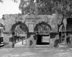
Historically, a camino real (Royal Road) is defined as a road that connects Spanish capital with Spanish capital, a distinction not shared with roads connecting ordinary Spanish or Indian villages. The term Camino Real implied that the status and privileges granted to the villas and capitals it connected were extended to the main routes of travel through use by officials and others acting in the interest of the crown. Unlike ordinary Indian and Spanish villages, villas like San Antonio and others along the route had charters that prescribed royal privileges.
Innovations
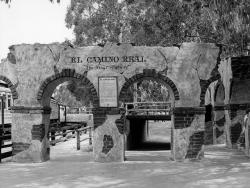
Historically, a camino real (Royal Road) is defined as a road that connects Spanish capital with Spanish capital, a distinction not shared with roads connecting ordinary Spanish or Indian villages. The term Camino Real implied that the status and privileges granted to the villas and capitals it…
Read More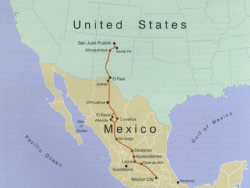
El Camino Real (literally, "the royal road") is the oldest and longest historical trail in the Western Hemisphere. The transportation link has, through the centuries, been called various names, including El Camino Real de Tierra Adentro (literally, "the road to the interior" because the U…
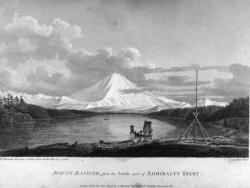
The voyage of Captain George Vancouver, 1791 -1795, was commissioned by the British Admiralty to map in detail the west coast of North America from Mexico to Alaska and to meet with Spanish authorities on the coast to enforce the terms of the Nootka Sound Convention of 1790.
Departing…
Read More

